Cheyenne, WY (National Weather Service) February 5th, 2024 — Warmer temperatures have returned for the start of the week. Areas of fog will impact the Monday morning hours before we begin the warm-up trend. Daytime highs will help melt some of that snow that recently occurred over the weekend for parts of the forecast area. Breezy winds make a return by mid-week with the likelihood of mountain snow showers. Get your forecast at: weather.gov/cys
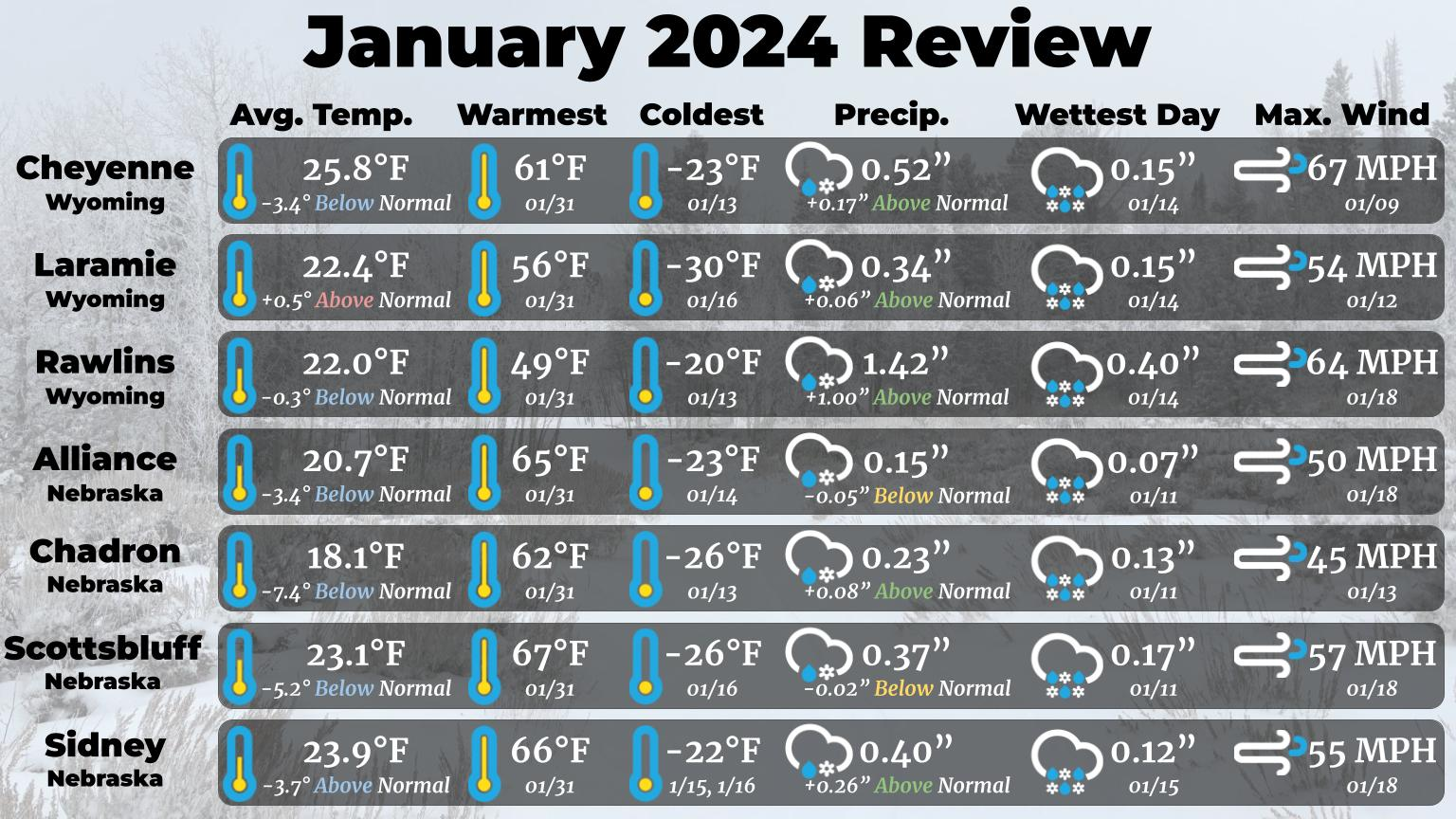
Here’s a look back at January weather across our area. Temperatures were quite volatile last month, bringing both extreme cold and unusual warmth! East of I-25, the cold far outpaced the warmth, leading to a much colder than average month. The mid-January arctic cold snap brought some of the coldest January temperatures in the last several decades! (Likely coincidentally, most of the severe cold snaps in recent years have occurred in either December or February). The warmth and cold were more balanced for Laramie and Rawlins, which saw near normal temperatures. A few locations saw impressive differences between the monthly high and the monthly low. The largest was Scottsbluff, which saw a 93F temperature spread between the low of -26F on 1/16 and the high of 67F on 1/31! This was the 3rd largest spread in temperature between the January high and January low since 1893. Most locations ended up near to slightly above average on precipitation and snowfall, nearly entirely thanks to the series of storms that impacted our area in the middle of the month. Mountain snow-pack made up a little bit of ground last month, but most locations remain below average in terms of snow water equivalent on the ground. The Sierra Madre range is closest to normal at 87% of median, while the South Laramie range is furthest behind, with only 23% of median snow-pack currently present.