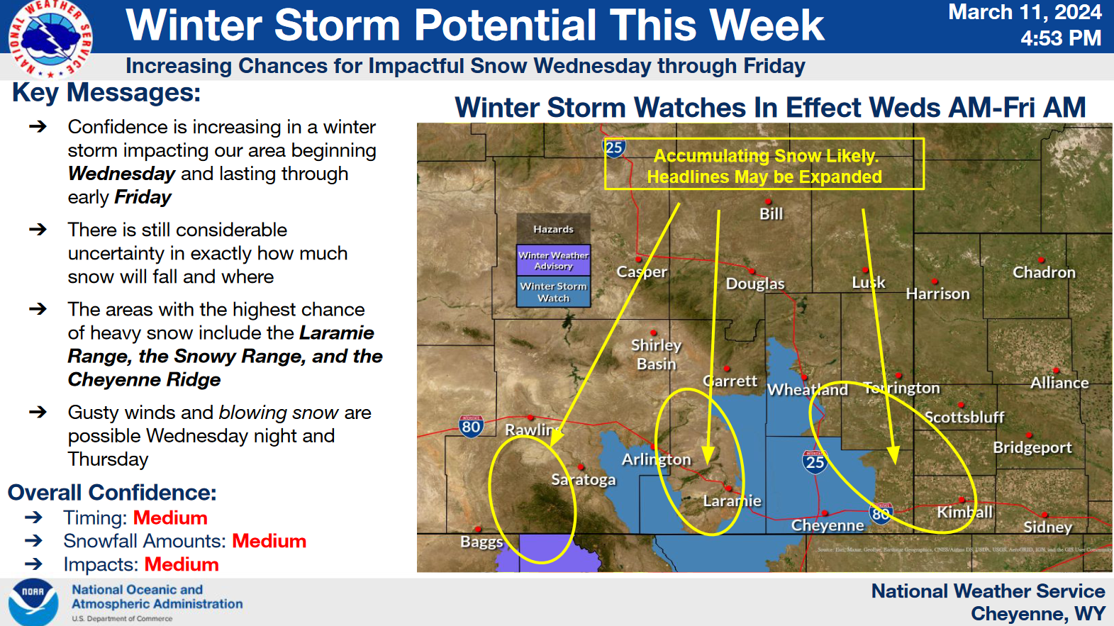
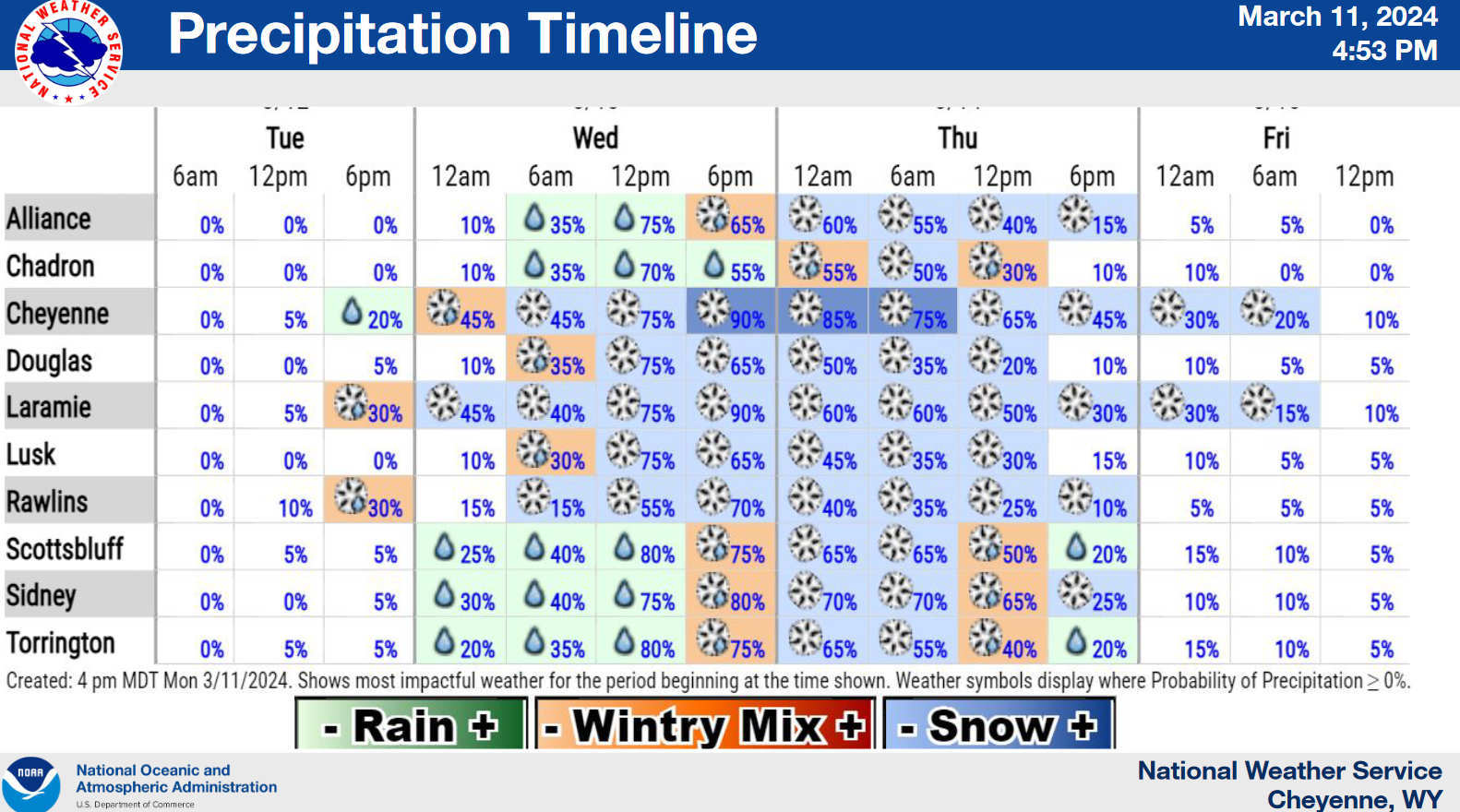
Cheyenne, WY (National Weather Service) March 12th, 2024 — Here’s a look at the five day forecast across southeast Wyoming and Nebraska Panhandle. A nice day Tuesday, before a cold front approaches from the west Wednesday morning. Looking at widespread snow developing west of the Laramie Range Wednesday afternoon as the front pushes through the area. Initially rain will be common east Wednesday, before turning over to snow Wednesday evening. Heaviest snow looks to occur Wednesday evening through Thursday evening. Breezy northeast winds gusting to 30-35 mph could create areas of blowing snow and poor visibility, that will add to impacts during this time. Winter Storm Watches are in effect for Wednesday and Thursday for portions of southeast Wyoming. Snow expected to end Friday morning from north to south. Dry weather and breezy Saturday.